


Copeland Voting District, Boundary County, Idaho
About
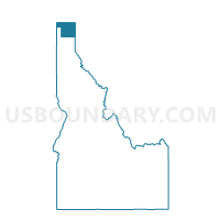
Outline

Summary
| Unique Area Identifier | 563891 |
| Name | Copeland Voting District |
| County | Boundary County |
| State | Idaho |
| Area (square miles) | 563.76 |
| Land Area (square miles) | 560.47 |
| Water Area (square miles) | 3.30 |
| % of Land Area | 99.42 |
| % of Water Area | 0.58 |
| Latitude of the Internal Point | 48.86705240 |
| Longtitude of the Internal Point | -116.54072650 |
Maps


Graphs
Select a template below for downloading or customizing gragh for Copeland Voting District, Boundary County, Idaho


Neighbors
Neighoring Voting District (by Name) Neighboring Voting District on the Map
- Bonners Ferry Voting District, Boundary County, ID
- Lamb Creek Voting District, Bonner County, ID
- Metaline Falls Voting District, Pend Oreille County, WA
- Moyie Voting District, Boundary County, ID
- North Bonners Ferry Voting District, Boundary County, ID
- Priest Lake Voting District, Bonner County, ID
Top 10 Neighboring County Subdivision (by Population) Neighboring County Subdivision on the Map
- Bonners Ferry CCD, Boundary County, ID (6,685)
- Priest River CCD, Bonner County, ID (5,293)
- Troy CCD, Lincoln County, MT (3,576)
- Moyie Springs CCD, Boundary County, ID (2,423)
- Ione-Metaline Falls CCD, Pend Oreille County, WA (2,099)
- South and West Boundary CCD, Boundary County, ID (1,864)
Top 10 Neighboring Elementary School District (by Population) Neighboring Elementary School District on the Map
Top 10 Neighboring Secondary School District (by Population) Neighboring Secondary School District on the Map
Top 10 Neighboring Unified School District (by Population) Neighboring Unified School District on the Map
- West Bonner County School District 83, ID (11,433)
- Boundary County School District 101, ID (10,972)
- Selkirk School District, WA (2,213)
Top 10 Neighboring State Legislative District Lower Chamber (by Population) Neighboring State Legislative District Lower Chamber on the Map
- State House District 7, WA (130,475)
- State House District 1, ID (40,210)
- State House District 2, MT (10,711)
Top 10 Neighboring State Legislative District Upper Chamber (by Population) Neighboring State Legislative District Upper Chamber on the Map
- State Senate District 7, WA (130,475)
- State Senate District 1, ID (40,210)
- State Senate District 1, MT (19,687)
Top 10 Neighboring 111th Congressional District (by Population) Neighboring 111th Congressional District on the Map
- Congressional District (at Large), MT (989,415)
- Congressional District 1, ID (841,930)
- Congressional District 5, WA (723,609)
Top 10 Neighboring Census Tract (by Population) Neighboring Census Tract on the Map
- Census Tract 9701, Boundary County, ID (5,647)
- Census Tract 9702, Boundary County, ID (5,325)
- Census Tract 5, Lincoln County, MT (3,576)
- Census Tract 9701, Pend Oreille County, WA (2,099)
- Census Tract 9506, Bonner County, ID (1,940)
Top 10 Neighboring 5-Digit ZIP Code Tabulation Area (by Population) Neighboring 5-Digit ZIP Code Tabulation Area on the Map
- 83864, ID (17,076)
- 83805, ID (7,437)
- 59935, MT (3,576)
- 83845, ID (1,742)
- 99153, WA (467)
- 83826, ID (45)